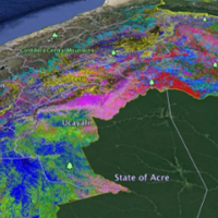
Remote sensing maps of the forest canopy in Peru are testing the strength of current forest protections and identifying new regions for conservation efforts, according to a report by the Carnegie Airborne Observatory. The study of biodiversity traditionally relies on fieldwork to inventory the types of species living in a habitat, and current satellites cannot observe forests with this level of detail. The MacArthur-supported Observatory uses airborne laser-guided imagining spectroscopy, a method that is now able to link the forest’s variety of species to the growth employed by canopy trees and other plants. The Observatory eventually wants to expand beyond Peru by putting similar instrumentation on a satellite to map the planet every month to monitor how the world’s biodiversity is changing.


